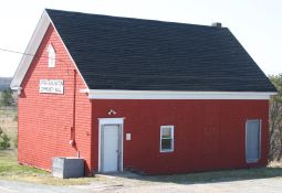
Upper Burlington
Community Hall
b
"The Old Schoolhouse"

Site Navigation

» Home

» Introduction
» Dedication and Acknowledgement

» Upper Burlington Community Hall
» Upper Burlington History
» Nova Scotia's Rural School
       History
» The Upper Burlington School
       Building & School Life
» The Teachers
» Annual School Pictures
»
Anecdotes
»
Upper Burlington Community Hall
       Association

» Tales from a One Room School?
 
Appendices
  » 1941 Upper Burlington School
       History Project Map
» School Registers
» The Bad Boy of Blanktown   
       School
» The Dufferin and Bed Bug
       Corner
» Trustees and the Teacher
  » Upper Burlington Section of
       1871 A. F. Church Map

» Origin of Normal School
» "School Lesson - 1907" Mural
» Planter Walking Trail
» Joe Howe and Free Schools
» A Country Schoolmaster 1850
» Teachers' Pioneer Ancestor
   
» Email


Upper Burlington Section of 1871 A. F. Church Map
Showing School House Location


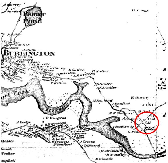
A.F. Church published a series of 4 ft x 4.5 ft maps, one for each county, in the 1871-1885 period. That for Hants County from which the above is derived, was compiled about 1869 or earlier. In the lower right hand section above is the area of the schoolhouse, which itself is marked by “S.H.”. The layout of the roads is pretty much as today, except for the northern portion of the Old Walton Road which is now abandoned, and the former straight run across the dyke to the bridge. Family names of Salter, Sanford, Burgess, Fish, Harvey, Smith, Brightman, and Dill are indicated for the full Upper Burlington section. Full size copies of the map are available from N.S. Natural Resources for about $20.


Home